Categories
geo gov mobile my projects open data open source policy

Outreach and Mobile: opening institutions to their wider community

[Disclaimer: this post represents my own view and not that of my employer. As if you didn’t know that already.]

Do the words “mobile portal” appeal to you?

I have been working extensively, with a small team, to launch St. George’s University of London‘s mobile portal since last January after we decided to go down the road of a web portal rather than that of a mobile app. The reason for this choice is pretty clear: despite the big, and growing, success of mobile apps, we didn’t want to be locked in to a given platform or to waste resources on developing for more platform. Being a small institution it’s very difficult to get resources to develop on one platform, even less on multiple ones. We also wanted to reach more and more users, and a mobile portal based on open, accessible, resources made perfect sense.

As many of the London-based academic institutions, St. George’s needs to account for two different driving forces: the first is that as an internationally renowned institution it needs to approach students and researchers all over the world; the second is that being based in a popular borough it is part of the local community for which it needs to become a reference point, especially in times of crisis. Being a medical school, based in a hospital and a quality NHS health care structure, emphasizes a lot the local appeal of this institution.

This idea of St. George’s as an important local institution was one of the main drives behind our mobile portal development.ย We surely wanted to provide a good, alternative, service to our staff and students, by letting them access IT services when on the move.ย However, the idea of reaching out to people living and working around us, to get St George’s better known and integrated within its own local community, lead us to a thriving experience developing and deploying this portal. “Can we provide the people living in Tooting, Wandsworth, and even London, with communication tools to meet their needs, while developing them for people within our institution?” we asked ourselves. “Can we help people find more about their local community, give them ideas for places to go, or show them how to access local services?“.

This coalition government had among its flagship policy that of a “Big Society”, having the aim “to create a climate that empowers local people and communities”. Surely a controversial topic, nonetheless helpful to rediscover a local role for institutions like us to get them back in touch with their own local community, which in some case they had completely forgotten.

In any London borough there are hospitals, universities, schools, societies, authorities. No matter their political affiliation, if each of these could do something, they would improve massively the lives of the people living within their boundaries. Can IT be part of this idea? I think so. I believe that communication in this century can and does improve quality of life. If I can now just load my mobile portal and check for train and tube times, that will help me get home earlier and spend more time with my family. If I can look up the local shops, it will make my choices more informed. It might get me to know more local opportunities, and ultimately to get me in touch with people.

Developing this kind of service doesn’t come with no effort. It required work and technical resources. We thought that if we could do this within the boundaries of something useful to our internal users, that effort would be justified, especially if we tried to contain the costs. With this view in mind, we looked for free, open-source, solutions that we might deploy. Among many frameworks, we came across Mollyproject, a framework for the rapid development of information and service portals targeted at mobile internet devices, originally developed at Oxford University for their own mobile portal. When we tried it for the first time, it was still very unstable and could not run properly on our servers. But we found a developers community with very similar goals to ours, willing to serve their town and their institution. We decided to contribute to the development of the project. We provided documentation on how to run the Molly framework on different systems, and became contributors of code. Molly was released with its version 1 and shortly afterwards we went live.

Inter-academic collaboration has been a driving force of this project: originally developed for one single institution, with its peculiar structure and territorial diffusion, it was improved and adapted to serve different communities. The great developments in the London Open Data Storeย allowed us to add live transport data to the portal, letting us have enthusiastic reactions from our students, and these were soon integrated in the Molly project framework with great help from the project community. I think this is a good example of how institutions should collaborate to get services running. A joint effort can lead to a quality product, as I believe the Molly project is.

The local community is starting to use and appreciate the portal, with some great feedback received an the Wandsworth Guardian reporting about a “site launched to serve the community”. I’m personally very happy to be leading this project as it is confirming my idea that the collaborative and transparent cultures of open source and open data can lead to improved services and better relationships with people around us, all things that will benefit the institutions we work for. The work is not complete and we are trying to extend the range of services we offer to both St. George’s and external users; but what we really care and are happy about is that we’re setting an example to other institution of how localism and a mission to provide better services can meet to help build better communities.
Categories
mobile my projects

Launching a mobile app

I know. I’ve been silent for too long.

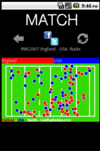
The reason is, as most of you know already, I’ve been developing and launching a mobile app. LiveRugby, inspired by the awesome work made by Colm on his TotalFootball and StatsZone apps, promises to be the definitive way to generate and share graphical analysis and statistics for the data-centric rugby fan during the next World Cup. I chose an app about rugby because is something I understand and I’m passionate about. I wanted to learn more about rugby, and more about mobile applications, and this seemed the best opportunity.

I still can’t say much as many information are, in a way, “secret” until and I need to get some clearance from one of the suppliers. But, I promise, I’ll be writing soon about it.
For the moment, let me just give you a list of what I wanted to experiment with this venture:

  • Planning the application
  • Dealing with the supplier of data, OptaSports
  • Being able to project manage myself
  • Research what kind of statistics might be useful in a sport like rugby and how to display them in a way that is easy to understand to the average fan
  • Develop a full application on my own
  • Being able to outsource part of the artwork to a graphic designer
  • Launch the app on the market
  • Start a marketing campaign on my own getting in touch with press and media
  • Communicating and satisfying customers-users

At the moment the app is launched on the Android market, although I’m already working for an iPhone version for the RBS 6 Nations. Of course, a business venture like this is successful when a profit is made out of it.
However, there are several other measures of success that I need to take in account, roughly at every point of this list.

Whether this project has been a success or not will be subject to analysis and to a more detailed blog post when it will be time to make a balance. For the moment, I’m totally enjoying the learning experience it has been so far, and the constant challenge posed by launching your own enterprise.

I’d like to know what my readers think ๐Ÿ™‚

Categories
geo geomob mobile Web 2.0

GeoMob, 12 May 2011

A good level of participation for yesterday night GeoMob. Despite two speakers’ defections we had a well balanced schedule (one big company, one researcher, one startup) and a rich Q&A session. Here’s my usual summary with some thoughts embedded.

Microsoft Bing Maps, by Vikas Arora (@vikasar), Solution Sales Specialist
General show-case talk as we often have from big companies. However, some interesting products seem to be coming out of the Microsoft pipeline, especially StreetSlide and the partially related Photosynth. Some awesome novelty (although not immediately usable) like the amazing live Augmented Reality video stream on a static image view. I’m not totally sure the GeoMob crowd is the right one to show AR ๐Ÿ˜‰

There was some good debating about updating StreetSlide imagery, thanks to a question by Ollie. This is a well known problem in Google StreetView, especially in busy London High Streets where shops sometimes change hands multiple times in a year. As a result, by the time StreetView imagery has reached Google’s servers it displays a vintage version of reality. Vikas claims that by partnering with Navteq they will be able to update images every 4-6 months.

Vikas earns the best quote of the night award: “I can’t say much about Nokia except that it’s good for us”.

Mapping Surnames Geographically, by James Cheshire (@spatialanalysis), UCL Geography
I was absolutely fascinated by James’ work upon discovering it on the National Geographic Magazine some months ago. The general subject of this talk is showing how surname origins and popularity can be displayed on a map. Two works were presented about surnames in the US and in London.

The talk and the Q&A session highlighted both the power of a map to show surnames but also its limitations. There are obvious problems of visualization: short and long surnames being displayed in different size, choice of colours, positioning, density, granularity.

Although the map itself is a beautiful item, I think that its dynamic version, able to show the nth most popular surname,ย is more useful, but only if used… dynamically. What I mean is that in places that are true melting pots like London what it’s interesting is not what surname or surnames are the most popular, but rather what’s the distribution of names of a certain origin in a given place. In other words, given the assumption that certain surnames can be related to certain communities, it’s interesting to see that the first five most popular in a given area are sometimes from five different origins.

James was open about the issues of visualising surnames this way, especially about how to treat granularity (e.g. the Irish community in New York is not as big as it would be). There is lot of work to do in this area and a map is only the tip of the iceberg of research, development, coding, and imagination.

Introducing Eeve, by Jan Senderek (@jansenderek)
Impressive UI analysis for this young start-up whose goal is to let people have fun creating and sharing events. Jan, their CEO, delivered a very interesting talk about how UI can lead to a great mobile application. Their strategy of “mobile first, then web” is interestingly different by that of many other startups around. Event creation and sharing seems to have a mind-boggling peculiarity: initially, events will need to be created in the place where they will be held and shared immediately. No forward planning allowed, which sounds strange but might capture the fantasy of party goers. They plan to extend the service to let event organisers create entries.

The (long) Q&A session seemed critical but was truly interested. First of all, turning myself into the bad guy, I asked what makes them different from their competitors. I’ve attended GeoMob since 2009 and this is at least the third company introducing a similar service, and their unique selling point is not extremely clear. Surely, UI seems to be really good for their app, but is that enough to get to that critical mass of users needed to succeed?

Secondly, the business model seemed not very well defined. Although as any stealth startup Eeve wouldn’t probably disclose too much about it, the general perception was that they need to think about it a bit more accurately, and Jan admitted that.

However, I also have the general impression that small companies presenting at GeoMob (not just Eeve) tend to come just with their shiny iPhone application rather than with the backstage work which might be of great interest. This also gives the wrong impression that most of them are trying to monetise upon nothing more than a mobile app. As it turns out, one of the other LBS introducing at GeoMob a similar event-based app was also selling a CRM system to event organisers which is where their main revenue stream comes from. None of this was mentioned at the presentation and we were left wondering with the same questions.

I won’t mention all the discussions about stalking and privacy: we’ve done that for all companies providing LBS, so nothing new from that perspective. But it’s always good to have our @StevenFeldman pointing that problem out.

To be honest, I’m curious about Eeve and will probably try it out (paying attention to privacy, of course :P). It would be nice to have a report on how many users join the system and especially their B2B strategy.
Maybe for a next GeoMob?

Categories
humour mobile

4G? No, really?

Vic Gundotra on Android 2.2:

  • 2x-5x increase in speed (due to Just-in-time compilation)
  • tethering and portable hotspot
  • impressive voice recognition capabilities
  • cloud/app communication with instant mobile/desktop synchronisation
  • Adobe Flash (“It turns out that on the Internet, people use Flash.” is my favourite quote ever…)

Steve Jobs on iPhone 4G:

  • You can play Farmville

Do I need to add anything more? ๐Ÿ™‚

Categories
geo geomob mobile Web 2.0

A bunch of nerds with maps

…I think I can define GeoMob this way and I fit this definition perfectly ๐Ÿ™‚

Nice London Geo/Mobile Developers Meetup Group meeting yesterday at City University. High level of the talks, providing vision, reporting experiences, and showing technologies and nice uses of them. Here’s a short summary.

Andrew Eland – Mobile Team Lead for Google UK

A very Google-like talk, showing up tech pieces with their vision. Of course, disappointing if you were expecting more in-depth analysis of market, novel ideas, or anything more than current publicly known work. But we’re used to that, and it was not a bad talk at all ๐Ÿ™‚
Best quote: “Tokyo is a vertical city“. That’s absolutely true, and this fact has a direct impact on geo-apps: being shops, clubs, bars, developed vertically at different levels of the buildings (this is a pic I took of the Keio Sky Garden, for example, and there are hundreds of beer gardens up on the roofs of several skyscrapers!) there’s a real need for accurate altitude information and 3d-mapping, or at least altitude-enabled maps. The interesting question for me here is how we can show multi-floor information on the 2d-maps currently in use.

Julianne Pearce, Blast Theory
An artists’ collective perspective on geo-development. Absolutely intriguing, as not the average techietalk you would expect from a GeoMob. I found this personally interesting, as I played with the Can you see me know? game and even created a modified version of it at the UbiComp Spring School at Mixed Reality Lab, University of Nottingham in April 2009, during a workshop dealing with Locative Game Authoring.

PublicEarth
They introduced their concept of a web 2.0 site for creating a personal atlas. Basically it’s about putting photographs and commercial activities of interest on a personal map. They seem to be developing APIs and the possibility of creating widgets, and directly deal with small companies (hotels, b&b, restaurants, bars) to put them in their database. The idea here is that users will be allowed to tell the (possibly intelligent) system what categories of data they’re mostly interested in, leading to some kind of customised Michelin guide.
On monetization, they have a three-fold strategy:
– contextual advertisement, empowered by the fact that users are genuinely interested in what they put in their atlas
– share of profit on direct bookings
– [long-term] user base providing more content, improving quantity and quality of contextual data in a positive feedback loop, possibly making it interesting to other companies

Laurence Penney, SnapMap
My favourite talk of the night. Laurence has been longing for a way of placing precisely photographs on a map for more than 10 years.
I was astonished of seeing him doing many of the things I would have liked to see in web sites like Flickr and that I’ve been discussing for ages with my friends and colleagues! Using gps data, a compass, waypoints, directions, focal length, and all the other data associated with a photograph, Laurence is developing a web site to allow users navigate those pictures, even creating 3d views of them like the guys at University of Washington with Rome wasn’t built in a day. Funnily, he started all of these before gps/compass-enabled devices were available, writing down all of his data on a notebook, and he even had problems with the police inquiring why he was taking picture at the Parliament (unfortunately, I have to say he’s not alone -_-).

Mikel Maron – Haiti Earthquake OpenStreetMap Response
Mikel explained what OpenStreetMap did to help in Haiti. Disaster response relies heavily on updated maps of building, streets, and resources, and OSM quickly managed to get that done. A great thanks to him and to all of OSM guys to show the world that mapping can be helpful to people even leaving out profit considerations.

Categories
geo geomob mobile Web 2.0

At the #GeoMob

Hey folks, long time I haven’t blogged – been very busy at work and home! Let me resume my techie stuff by summarising some of my thoughts after the #GeoMob night at the British Computer Society, last 30 July.
The #GeoMob is the London Geo/Mobile Developers Meetup Group, and it organises meeting of developers interested in the geo/social/mobile field, usually with participation from industry leaders (Yahoo!/Google), businesses, startups.

This are my thoughts about the night, grouped by talk:

Wes Biggs, CTO Adfonic

  • AdFonic is a mobile advertisement provider that launched 1/7/09 (their home page doesn’t work, though. You need to go to http://adfonic.com/home)
  • what about user interaction and privacy? if I don’t get it completely wrong (reading here it seems I haven’t), the actual user experience is to have some kind of advertisement bar on your mobile application. If it’s just this, it’s simply the porting of an old desktop idea to the mobile environment. The problem is that it was not a hugely successful idea. Here the user is rewarded even less compared to the desktop bars (I guess by getting the app for free?). I’m not sure this can be a really successful venture unless the ads are smartly disguised as “useful information” – but, hey, I’m here to be refuted ๐Ÿ˜›
  • getting contextual information is difficult, even if you know the location of the user you don’t know what he/she’s doing. Good motto from the talk “advertisers are not interested in where you are, but in where you’re at“. But how to get and use these contextual information was not really clear from the talk. From their website’s FAQ, I read:
    • You can target by country or region.
    • You can target by mobile operator.
    • You can define the days of the week and the time of day you wish your ad to be displayed in the local market.
    • You can choose to target by demographics by selecting gender and age range profiles.
    • You can choose devices by platform, brand, features and individual models.
    • You can also choose to assign descriptive words for your campaign using tags. We compare these tags to sites and apps in the Adfonic network where your ad could be displayed, improving your ad’s probability of being shown on a contextually relevant site.

    This raises a couple of privacy concerns, as well as technical ones ๐Ÿ˜‰

  • I would say this talk raised more questions than those answered – nonetheless it was, at least for me, good for brainstorming about mobile targeting
  • some of the issues with this service – which I’m really interested in watching to know where it heads to – are interestingly the same of a paper about leisure mobile recommender systems that I reviewed for MobBlog

Henry Erskine Crum, @henryec, Co-founder of Spoonfed

  • Spoonfed is a London based web startup (Sep. 2008) that focuses on location-based event listings
  • 12 people work there – which makes it interestingly big to be a startup
  • very similar to an old idea of mine (geo-events but in a more social networking fashion) – which prompts me to realize I need to act fast, when I have such ideas ๐Ÿ™‚
  • I would have liked the talk to dig deeper into details about user base, mobile apps and HCI issues, but it was not a bad talk and it provided a very operational and yet open minded view of how the service works and evolves
  • oh, and Henry was congratulated as the only guy in a suit (:P lolcredits to Christopher Osborne)

Gary Gale, @vicchi, Director of Engineering at Yahoo! Geo Technologies, with a talk about Yahoo! Placemaker

  • get here the slides for this talk
  • Yahoo! Placemaker is a useful service to extract location data from virtually any document – also known as Geoparsing. As the website says: Provided with free-form text, the service identifies places mentioned in text, disambiguates those places, and returns unique identifiers for each, as well as information about how many times the place was found in the text, and where in the text it was found.
  • I see it very interesting especially as it is usable with Tweets and blog posts, and it can help creating very interesting mashups
  • only issue: its granularity is up to the neighbourhood – which is perfectly good for some applications, but I’m not sure it is also for real-time-location-intensive mobile apps

Steve Coast, @SteveC, founder of OpenStreetMap and CloudMade, with a talk about Ubiquitous GeoContext

  • OpenStreetMap can be somewhat considered the community response to Google Maps: free maps, community-created and maintained, freely usable – CloudMade being a company focusing on using map data to let developers go geo
  • the motto from this talk is “map, please get me to the next penguin in this zoo” – that is, extreme geolocation and contextual information
  • success of a geo app – but according to me also applicable to many Internet startups – summarized in 3 points:
    • low cost to start
    • no licensing problems
    • openness / community driven effort
  • it was an absolute delight to listen to this talk, as it was fun but also rich of content – the highly visual presentation was extremely cool, I hope Steve is going to put it online!

Oh, and many thanks to Christopher Osborne, @osbornec, for organising an amazing night!